
15 Famous Landmarks in Africa to Visit

Destguides may receive commissions from purchases made through affiliate links in this article.

Africa is the second-largest continent, home to 55 countries and around 100 UNESCO World Heritage Sites. Its landscapes span from the world's largest hot desert to snow-capped volcanic peaks and sprawling grasslands teeming with wildlife.
The continent holds some of the oldest evidence of human existence, alongside architectural feats that have stood for millennia. Whether you are drawn to geological wonders or some of the richest biodiversity on the planet, Africa delivers on every front. Continue reading to discover 15 of the most famous landmarks in Africa and what makes each one worth the journey.
15 Famous African Landmarks
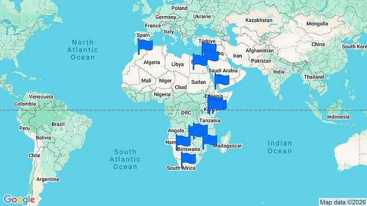
Africa Landmarks Map
A map of Africa landmarks. Use the map to explore all of the points of interest.

The Great Pyramids of Giza
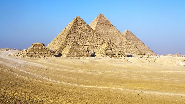
The Great Pyramids of Giza are among the oldest and most recognizable structures ever built. Built roughly 4,500 years ago as royal tombs for the pharaohs, these Egyptian landmarks remain the only surviving wonder of the Seven Wonders of the Ancient World.
Located near Cairo, the complex includes three main pyramids: the Great Pyramid (built for Pharaoh Khufu), the Pyramid of Khafre, and the Pyramid of Menkaure. The Great Sphinx, a limestone statue with the body of a lion and a human head, guards the plateau in front of them.

The Nile River
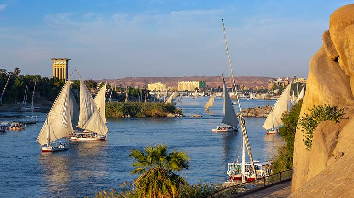
Stretching roughly 6,800 kilometers through northeastern Africa, the Nile is traditionally recognized as the longest river. It flows through 11 countries before emptying into the Mediterranean Sea, and its two main tributaries are the White Nile, which originates at Lake Victoria, and the Blue Nile, which begins at Lake Tana in Ethiopia. The two branches converge in Khartoum, Sudan.
A Nile River cruise is a popular way to experience the river, passing ancient tombs and temples along the way. It is a highlight of any Egypt itinerary. Activities along the Nile range from kayaking and fishing to white-water rafting, and the river's source at Lake Victoria in Uganda is worth a visit for those wanting a closer look.

The Valley of the Kings
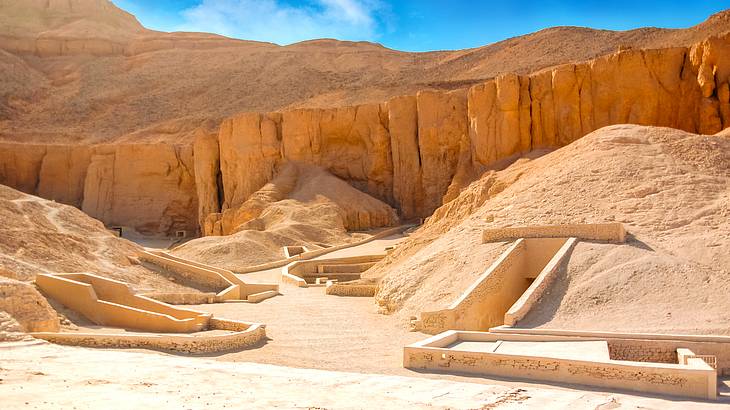
Between the 16th and 11th centuries BCE, pharaohs, queens, and nobles of Egypt's New Kingdom were buried in a hidden valley on the west bank of the Nile in Luxor. The Valley of the Kings holds at least 63 discovered tombs, including that of Tutankhamun, and is designated a UNESCO World Heritage Site.
Unlike the highly visible pyramids, these tombs were carved into desert cliffs to deter looters. The walls inside are decorated with vivid paintings and hieroglyphic texts depicting the journey to the afterlife. Early mornings are the best window to avoid both the crowds and the intense heat.

Victoria Falls
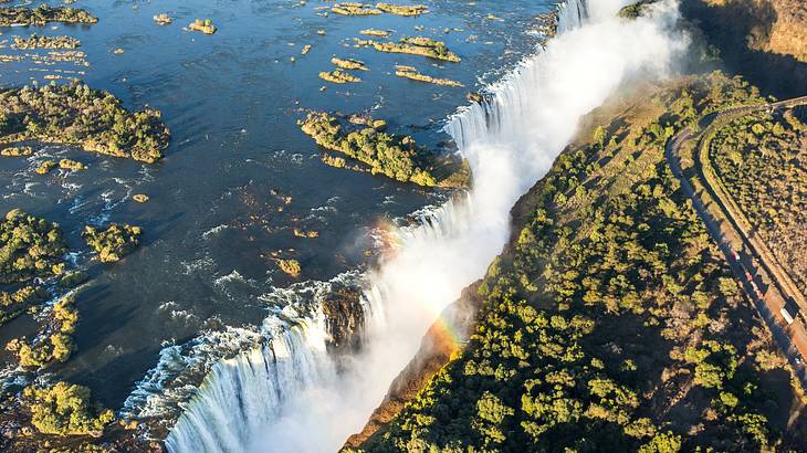
Standing 108 meters high and stretching 1,708 meters wide along the Zambezi River, Victoria Falls is the largest single curtain of falling water on Earth. The waterfall sits on the border of Zambia and Zimbabwe and is recognized as one of the Seven Natural Wonders of the World.
The spray from the falls feeds a surrounding rainforest and can be seen from kilometers away. On the Zambian side, visitors can swim in natural rock pools near the edge during the dry season when water levels drop. The local Lozi name, Mosi-oa-Tunya, translates to "the Smoke That Thunders," a fitting description for the thunderous roar and ever-present mist.

Serengeti National Park
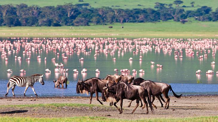
One of the densest concentrations of large mammals anywhere is found in the Serengeti National Park, a roughly 14,750-square-kilometer stretch of protected savanna in northern Tanzania. The park supports one of the largest lion populations on the continent.
The Serengeti is best known for the Great Wildebeest Migration, during which over a million wildebeest, along with zebras and gazelles, travel across the plains in search of fresh grazing. Game drives may also reveal elephants, hyenas, leopards, and cheetahs. Birdwatching is rewarding in the early morning and late afternoon hours.

Mount Kilimanjaro
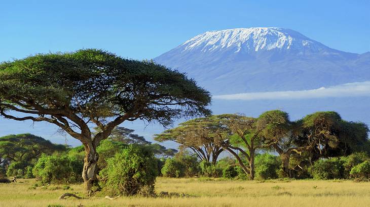
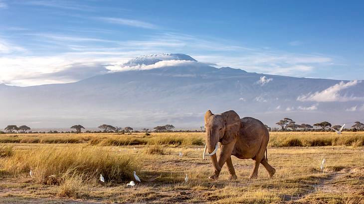
At 5,895 meters (19,341 feet) above sea level, Mount Kilimanjaro is the highest mountain in Africa and the tallest freestanding mountain. It is located entirely within northeastern Tanzania, near the border with Kenya, and sits within Kilimanjaro National Park.
Kilimanjaro is a dormant stratovolcano with three volcanic cones: Kibo (the highest), Mawenzi, and Shira. The climb passes through five distinct ecological zones, from tropical rainforest at the base to arctic conditions at the summit.
No technical climbing equipment is required, which is part of its appeal for trekkers of varying experience levels. The park also shelters wildlife, including the critically endangered black rhinoceros.

Ngorongoro Crater
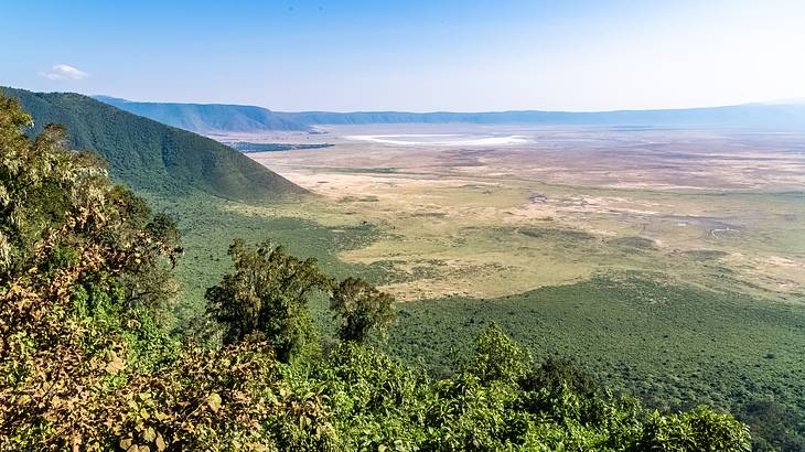
Roughly 2.5 million years ago, a massive volcano in northern Tanzania erupted and collapsed, forming what is now the Ngorongoro Crater. It is the world's largest intact and unfilled volcanic caldera, measuring between 16 and 19 kilometers in diameter with walls reaching depths of 400 to 610 meters.
The crater floor, covering about 260 square kilometers, supports grasslands, swamps, forests, and a shallow alkaline lake. It is home to over 25,000 large animals, including the endangered black rhinoceros and a dense population of lions. The indigenous Maasai people also live within the broader conservation area, maintaining their pastoral traditions alongside the wildlife.
Lalibela Rock-Hewn Churches
In the mountain town of Lalibela in northern Ethiopia, 11 medieval churches have been carved directly out of solid rock. Dating to the 12th and 13th centuries CE, these monolithic structures were chiseled from the surrounding volcanic tuff without any traditional building blocks or mortar.
The most photographed of the group is Bete Giyorgis (Church of St. George), carved in the shape of a cross and set into a deep trench in the rock. The churches remain active places of worship, tended by priests and monks, and the entire complex is a UNESCO World Heritage Site.
Ethiopian Orthodox Christian pilgrims gather here in large numbers during Timkat (Epiphany) and Genna (Christmas), making those periods both crowded and culturally rich.

Sossusvlei
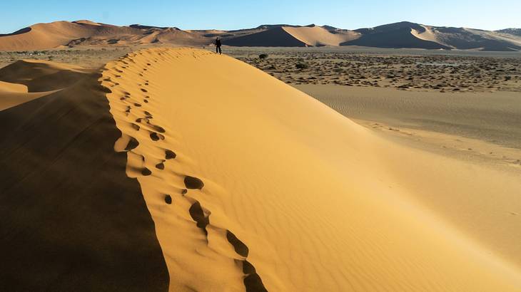
A clay and salt pan surrounded by some of the tallest dunes on the continent, Sossusvlei sits within the Namib-Naukluft National Park, one of the largest conservation areas in Africa. The name translates lossely to "dead-end marsh," a reference to the Tsauchab River, which flows into the area but never reaches the sea.
The dunes here exceed 300 meters in some places. Their deep red-orange color comes from iron oxide in the sand, which has oxidized over thousands of years.
The contrast of red dunes, white clay pans, and blue sky has made Sossusvlei a favorite for landscape photographers. Hot air balloon rides over the dunes offer a perspective that is hard to match from the ground level.

Sahara Desert
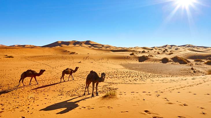
The Sahara is the largest hot desert, covering an estimated 9.2 million square kilometers across North Africa. In Morocco, the desert is most accessible via the Erg Chebbi and Erg Chigaga dune fields, where sand dunes reach heights of over 150 meters.
Visitors can experience overnight stays in desert camps and quad biking excursions. Despite the harsh conditions, wildlife does inhabit the Sahara, including the addax, Barbary sheep, and the Dama gazelle. Pack layers even in summer, as desert temperatures swing dramatically between day and night.

Medina of Marrakech
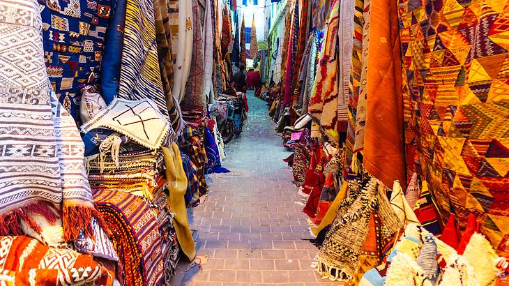
At the heart of Marrakech, one of the best places to visit in Morocco, lies its historic walled old city, dating back to the 11th century. At its center is Jemaa el-Fna, a large public square that has served as a marketplace and social gathering point for centuries.
The nearby Koutoubia Mosque, with its 77-meter minaret, is the city's most prominent religious landmark. The surrounding souks are an explosion of color and scent, selling everything from spices and dried fruits to pottery and leather goods.
As evening falls, the square fills with food stalls, musicians, and storytellers. For a calmer medina experience, the coastal town of Essaouira is a worthwhile alternative.
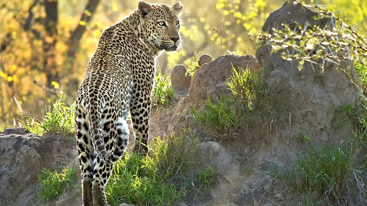

Kruger National Park
Kruger National Park is one of Africa's largest game reserves, covering nearly 20,000 square kilometers in northeastern South Africa. The park is home to the Big Five: the African elephant, lion, leopard, black rhinoceros, and Cape buffalo.
Beyond the large mammals, Kruger shelters over 500 bird species and features landscapes ranging from bushveld savanna to dense riverine forest, with iconic trees like giant baobabs, marula, and fever trees.
The Wolhuter trail is one of several multi-day walking routes within the park. The Albasini ruins, remnants of a 19th-century Portuguese trading post, add a layer of history to the natural surroundings.
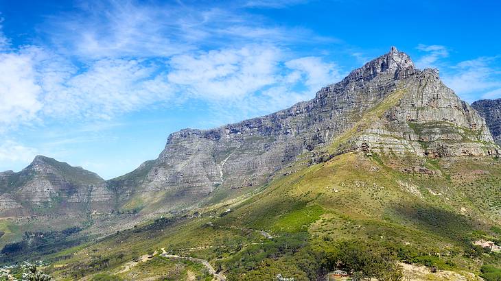

Table Mountain
Some of the rocks that make up Table Mountain are estimated to be over 500 million years old, making it one of the oldest exposed rock formations. Rising 1,084 meters above Cape Town, South Africa, its flat-topped summit is the result of millions of years of erosion.
The mountain is part of Table Mountain National Park, which falls within the Cape Floral Kingdom, one of the richest plant regions on the planet.
Visitors can reach the summit by cable car or on foot via several hiking routes, including the popular Platteklip Gorge trail. From the top, panoramic views stretch across Cape Town, the Atlantic coastline, and on clear days as far as Robben Island.
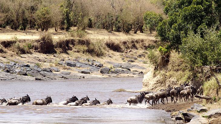

Maasai Mara National Reserve
Contiguous with Tanzania's Serengeti National Park, the Maasai Mara National Reserve covers about 1,510 square kilometers of savanna in southwestern Kenya. Together, the two form one of Africa's most important wildlife ecosystems.
The reserve is also a key destination during the Great Wildebeest Migration, when millions of wildebeest, zebras, and gazelles cross from the Serengeti into the Maasai Mara between July and October each year.
Game drives here offer close encounters with lions, leopards, cheetahs, elephants, and hippos. The indigenous Maasai people have inhabited the surrounding region for centuries.
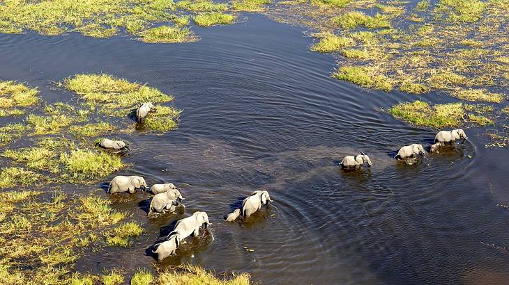

Okavango Delta
Where the Okavango River empties into the Kalahari Desert, it forms an inland delta rather than flowing to the sea. The water fans out across nearly 20,000 square kilometers of channels, lagoons, and islands in northwestern Botswana before evaporating and seeping into the sand.
The delta floods seasonally, fed by summer rains in the Angolan highlands, creating a lush wetland habitat in the middle of an otherwise arid landscape.
The result is an extraordinary concentration of wildlife, from hippos and elephants to wild dogs, leopards, and hundreds of bird species. Exploring by mokoro (a traditional dugout canoe) is one of the best ways to experience the delta's waterways close up.
In Summary
From the 4,500-year-old pyramids of Giza to the volcanic calderas of East Africa, Africa's landmarks span a staggering range of time, terrain, and human achievement.
These 15 sites barely scratch the surface of what the continent offers, but each one rewards the effort it takes to get there. Whatever draws you to Africa, prepare to leave with a deeper understanding of both the natural world and the civilizations that have shaped it.

Want to keep exploring?
Subscribe for our latest guides.
Thank you for subscribing
We will be in touch soon with our latest guides.
Want to keep exploring?
Subscribe for our latest guides.
Thank you for subscribing
We will be in touch soon with our latest guides.